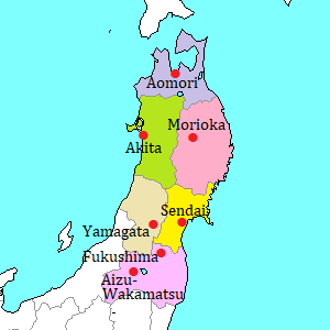
Taro district [田老]
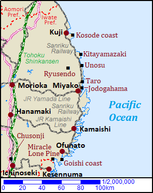
Taro district in Miyako city is located about 10 km north of the center of the city.
In Japanese, the "o" in the word is pronounced long, and it is read as "Tarô".
The district is located by the small bay, and there is a fishing port.
Because the bay is small, this district has often been severely damaged by tsunami since ancient time.
Therefore, the district constructed huge seawalls.
The construction started in 1934, and completed in 1978.
The double seawalls 10 meters high guarded the district inside the coastline, and the total length was over 2.4 kilometers.
It was called as "the Great Wall of China".
The people in this district had high awareness of disaster risk management.
And the preparation for tsunami was famous in Japan.
On March 11 in 2011, the Great East Japan Earthquake occured at 14:46, then the tsunami reached here at 15:25.
But the tsunami was too enormous.
It is estimated that the height of the tsunami was over 20 meters.
The tsunami rode over most seawalls easily and destroyed the district rapidly.
About 200 people were left dead or missing by the tsunami.
Huge seawalls were the people's last hope, but they were useless.
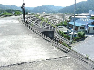
Former seawall in Taro (2007),
Photo by Kihkyef [CC BY-SA 3.0],
from Wikimedia Commons
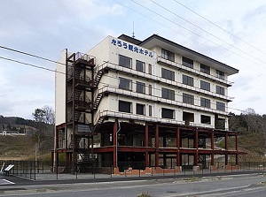
Taro Kanko Hotel,
Photo by Yasu [GFDL or CC BY-SA 3.0],
from Wikimedia Commons
Taro Kanko Hotel (たろう観光ホテル)
Taro Kanko Hotel was a six-storied hotel.
It is located about 1.2 km northeast of Taro station of Sanriku Railway, and about 200 meters north of Taro fishing port.
The huge tsunami on March 11 in 2011 destroyed most houses and buildings in the district.
Even this building constructed with reinforced concrete in 1986 was fatally damaged.
The lower three stories were destroyed, and it is said that the sea water of tsunami came to the 4th floor.
Especially, only the steel frames survived on the 1st and 2nd floors.
Fortunately, because the great earthquake occured just before check-in time, there was no guest.
And, all employees of the hotel had taken refuge when the tsunami came.
In 2014, Japanese government decided to preserve this building as one of the Ruins of the Great East Japan Earthquake.
After some repairs, it has been open to the public since April in 2016.
The free guided tour is held by Miyako city, so you can join the tour.
Sanno-iwa rocks (三王岩)
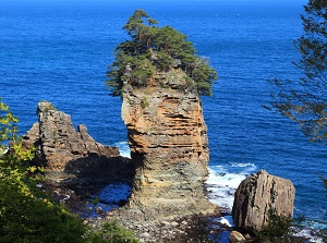
Sanno-iwa
Photo by Iwate Prefecture
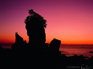
Sunrise at Sanno-iwa
Photo by Iwate Prefecture
They are three huge rocks standing by the sea, and it is located about 200 meters east of Taro fishing port.
"Sanno-iwa" in Japanese means "rocks of three kings".
The center rock is "Otoko-iwa" (Rock of man, 50 meters high).
"On'na-iwa" (Rock of woman, 23 meters high) is to the left, and "Taiko-iwa" (Rock of drum, 17 meters high) is to the right.
Otoko-iwa has a marine cave at its foot.
It is said that these rocks have been formed by the power of the sea wave and wind for 100 million years.
Of course, the rocks overcame the huge tsunami.
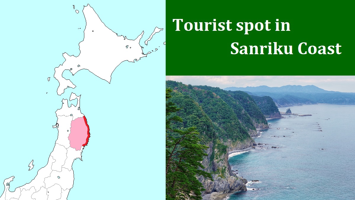
How to get here
By Sanriku Railway, about 20 minutes from Miyako station to Taro station.