Mount Aso [阿蘇山]
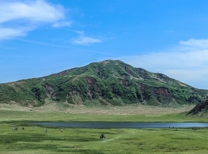
Nakadake of Mt. Aso from Kusasenri
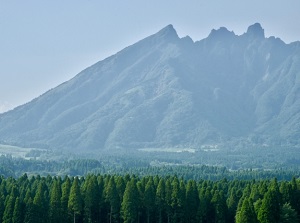
Nekodake of Mt. Aso
Mount Aso ("Asosan" in Japanese) is one of the world's largest caldera volcano.
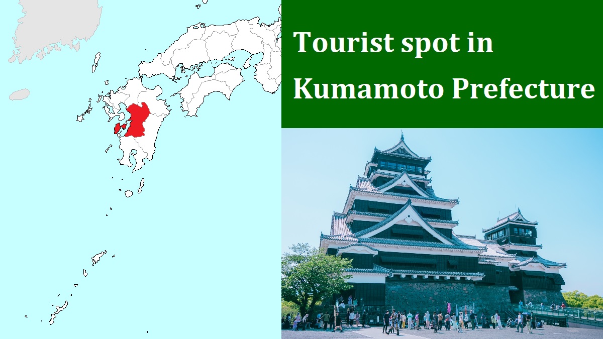
It is located about 30 to 50 km east of Kumamoto city.
It is an active volcano, and has sometimes erupted.
The eruptions in 1958 and 1979 resulted in injury and loss of life.
The whole mountain covers a range of about 18 km from east to west and about 25 km from north to south.
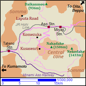
There is a large central cone and a somma surrounds the caldera.
The central cone has five peaks, and some of them have craters.
The highest peak is Takadake (高岳) and has an altitude of 1,592 meters.
Nakadake (中岳, 1,506 m) is located just west of Takadake and is the second hightest peak.
It has always been active.
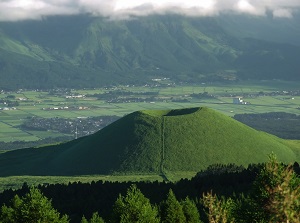
Nokodake (根子岳, 1,433 m) is located about 5 km east of Nakadake.
The jagged shape of top is attractive.
Two rivers flow along the valley on the north and the south foots of the central cone.
The rivers join at the western edge, and the river flows out of the caldera toward west.
There are villages, pastures and farmlands in the valley along the river, and the national roads and railroads run there.
It is said that the caldera with towns isn't seen even in other parts of the world.
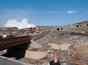
Around the crater of Nakadake of Mt. Aso
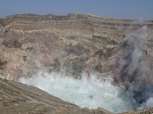
Crater of Nakadake of Mt. Aso
The main sightseeing spot is the crater of Nakadake.
To visit Nakadake, the main route is from JR Aso station in the north part of caldera, and the route bus is opeated to the foot of Nakadake. (Asosan-nishi bus stop)
A shuttle bus going to near the crater is operated from Asosan-nishi stop.
There are some observatories on the western edge of the crater.
And there is a parking lot for the car of tourist.
But, when the volcanic alert level has been raised by the local meteorological station, the operation of the bus is closed and all visitors can't go to near the crater.
Around the route from Aso station to Nakadake, there are a few popular spots.
Komezuka of Nakadake of Mt. Aso
Kusasenri-ga-hama of Mt. Aso
Komezuka (米塚) is a small volcano on the foot of the central cone, and is about 9 km southwest of Aso station.
The height is about 80 meters, and it is shaped like an upside-down bowl.
The entire surface is covered with grass, so it becomes a green mountain in spring and summer.
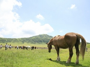
Kusasenri-ga-hama (草千里ヶ浜) is a gentle crater on the western foot of the central cone.
It is also simply called Kusasenri, and is the most popular spot in Mount Aso.
It was formed about 30,000 years ago, and the diameter is about 1 km.
Broad grass fields and some small ponds spread in the creater.
Cows and horses are pastured, and it is a picturesque scenery in Aso.
There is Aso Volcame Museum near Kusasenri-ga-hama.
It introduces Mount Aso as an active volcano.
And there is the visitor center and an observatory.
View from Daikanbou
Sea of clouds from Laputa Road
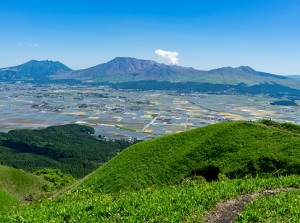
In the north part of Mount Aso, a relatively wide plain spread between the central cone and the somma.
There are some towns in the plain, and JR Aso station is around the center of the area.
There are a few spots around the plain.
Daikanbou (大観峰) is the highest peak of the somma.
It is located about 7 km north of Aso station, and the altitude is 936 meters.
There is an observatory on the top of the mountain.
We can see the good spectacle of Mount Aso and the wide plain in the caldera.
There is a parking lot for tourist near the observatory, but the route bus stop (Daikanbou-iriguchi) is about 2 km away from the observatoty.
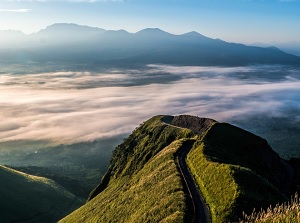
Laputa Road has become popular recently.
It is a winding narrow road on the mountainside of the somma and is located about 11 km west-northwest of JR Aso station.
The spectacle of Mount Aso and the wide plain is good.
In addition, when a sea of clouds fills the caldera, the scenery of the steep cliff and the winding road is similar to a scene in "Laputa: Castle in the Sky" which is a Japanese animated film by Studio Ghibli in 1986.
No route bus is operated to this place, so you must use a rental car or bicycle.
How to get here
By limited express of JR Hohi Line, about 1 hour and 10 minutes from Kumamoto to Aso, about 1 hour and 50 minutes from Oita to Aso.
Or, by express bus connecting Kumamoto and Oita, to Aso station, about 1 hour and 10 minutes from Kumamoto station, about 1 hour and 20 minutes from Oita station.
By route bus, from Aso station, 26 minutes to Kusasenri stop, 35 minutes to Asosan-nishi stop.
By route bus for Tsuetate, from Aso station, 34 minutes to Daikanbou-iriguchi stop.