Aokigahara forest [青木ヶ原樹海]
Aokigahara forest
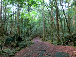
Walking trail in Aokigahara
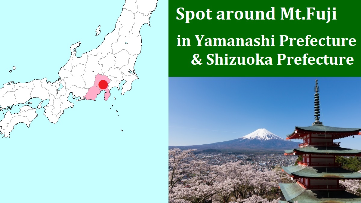
1) Fuji-Q Highland 2) Arakurayama Sengen Park
3) Shinobi-no-Sato 4) Oshino-hakkai
5) Shiraito Falls
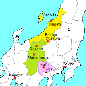
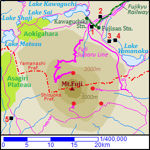
Red circles are the 5th stations and are the entrances of mountain trail.
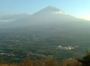
Aokigahara is the forest spreading at the northern foot of Mount Fuji.
It is located to the south of Lake Sai and Lake Shoji.
The forest spreads at the level of 920 to 1,300 meters, and the area is about 3,000 hectares.
In Japanese, it is called "Aokigahara-jukai", and "jukai" means "sea of trees".
This forest was formed on the lava plateau after the eruption of Mount Fuji in 864.
It is a primary forest mixing coniferous trees and broadleaf trees.
Some walking trails are set up, and we can enjoy walking in the woods.
But the forest is very thick and the ground in the forest is rugged with lava.
So if you have swerved a trail, you may be less able to return the original trail.
As a result, here has been a famous place for suicide.
There are many signages and posters to get diverted from suicide along the trails.
There are the following spots in this forest.
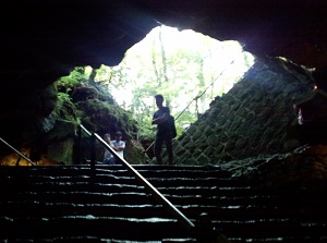
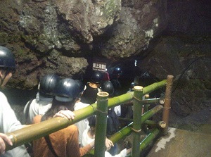
Entrance of Fugaku Wind Cave
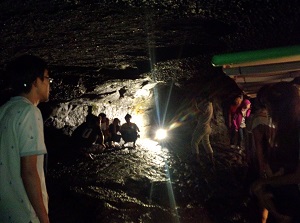
Inside of Fugaku Wind Cave
Fugaku Wind Cave (富岳風穴)
Fugaku Wind Cave is a popular lava cave located 2.5 km southwest of Lake Sai.
In Japanese, is is called "Fugaku-Fuuketsu".
It was one of the holes when the lava flow in 864 was cooling.
The length of the cave is 201 meters and the height is about 8 meters.
The average temperature in the cave is about 3 degrees C.
So we can see ice pillars in the cave even in summer.
You can explore this cave for about 15 minutes.
Narusawa Ice Cave (鳴沢氷穴)
To Narusawa Ice Cave
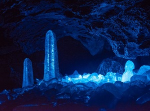
Ice pillars in Narusawa Ice Cave
Narusawa Ice Cave is also a popular cave located 1 km east of Fugaku Wind Cave.
In Japanese, is is called "Narusawa-Hyouketsu".
It was also formed after the eruption in 864.
The length of the cave is 156 meters and the height is only 1 to 3 meters.
The average temperature in the cave is also about 3 degrees C.
But, because water is dripping in the cave, we can see some ice pillars and the flozen ice on the walls.
So, this cave had been used as a storage for ice until the 19th century.
You can explore this cave for about 15 minutes.
Ryûgû Cave (竜宮洞穴)
Ryûgû Cave is a lava cave located 1.2 km north of Narusawa Ice Cave.
It is a small cave and the length is about 60 meters.
It is enshrined a god of water, so there is a small shrine near the entrance in the cave.
And because the inside of the cave is dangerous, we can enter only to 10 meters from the entrance.
Koumori-ana (蝙蝠穴)
Koumori-ana is a lava cave located 1 km north of Ryûgû Cave.
It is located near Lake Sai.
The length of cave is more then 350 meters.
"Koumori-ana" means "bat cave" in English, and three kinds of bats are living in this cave.
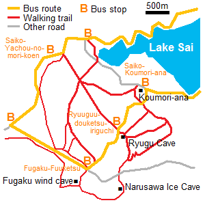
How to get here
From Kawaguchiko station, the route bus "Retro bus" is operated.
It runs around Aokigahara area.
The main bus stops to walk on the trails are "Saiko-Yachou-no-mori-kouen", "Fugaku-Fuuketsu" and "Ryugu-douketsu-iriguchi" and "Saiko-Koumori-ana".
From Kawaguchiko, about 35 to 50 minutes.