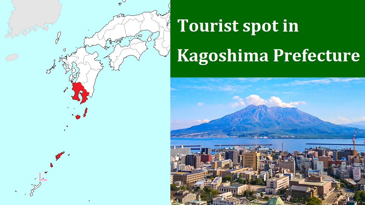
Sakurajima volcano [桜島]
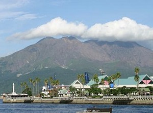
Sakurajima from Kagoshima Port
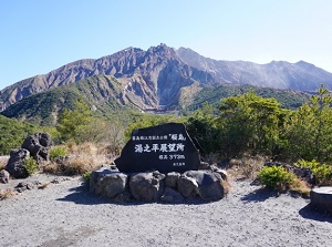
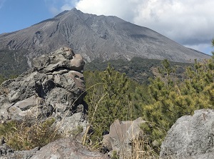
Yunohira View Point
Sakurajima is an active volcano, and is just east of central Kagoshima city.
It is a volcano towering in the center of Kagoshima Bay.
It was originally a volcanic island, and the volcanic activity started about 22,000 years ago.
Since recorded history, it has erupted more than 30 times.
Especially, the eruptions in the 1470s, 1780s and 1914 were very great.
The eruption in 1914 changed the map of Kagoshima.
The lava flowed down to the east and filled the narrow channel.
At last, the volcano island had attached to Osumi Peninsula.
Over 1 meters of the volcanic ashes fell around the volcano, and the fields of agricultural crops were completely destroyed.
"Sakurajima" is the name of the volcanic island.
It is about 12 km from east to west and about 10 km from north to south.
The formal name of the volcano is "Ontake".
Ontake has main 3 peaks.
They are Kitadake (1,117 m), Nakadake (1,060 m) and Minamidake (1,040 m).
Small villages are dotted along the coastline.
And farming is run on the land of volcanic ashes.
Sakurajima-daikon is a huge and turnip-shaped radish.
It is listed in the Guinness Book of World Records as the world's largest radish.
Sakurajima-komikan is a small mikan (seedless and easy-peeling citrus) within 5 centimeters.
It is also listed in the Guinness Book of World Records as the world's smallest mikan.
The volcano is still very active.
The volcanic eruption occurs tens of times every year.
When the eruption is a little large, the volcanic ash fells on Kagoshima city.
It is enough for bothering the people of Kagoshima city.
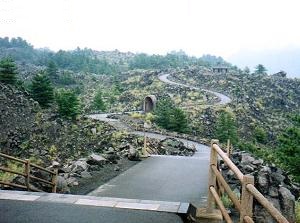
Arimura Lava Observatory
Walking trail on lava in Sakurajima
To visit Sakurajima, a ferry connects between Kagoshima Port and Sakurajima Port on the west coast of Sakurajima.
It is operated frequently, and it takes only 15 minutes.
There are two observatories on the foot of Sakurajima.
Yunohira View Point (湯之平展望所) is on a small peak 373 meters above sea level.
It is located about 2.5 km west of Kitadake peak.
It is the popular observatory to see the main peaks of Sakurajima at a short distance.
Arimura Lava Observatory (有村溶岩展望所) is an observatory on the south foot of the volcano.
It is in the field formed by the lava flown down in the eruption in 1914.
A walking trail is set up.
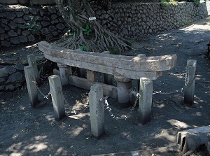
Kurokami buried Torii Gate
Photo: Kagoshima Prefectural Visitors Bureau

Sakurajima-daikon
Photo: Kagoshima Prefectural Visitors Bureau
Kurokami is a district on the east side of Sakurajima.
When the eruption in 1914 occured, a volume of volcanic ashes filled this district.
The Torii gate about 3 meters high in a Shinto shrine in the district was filled almost-totally.
It has been preserved to pass down the intensity of the eruption for posterity, and it is known as Kurokami buried Torii Gate (黒神埋没鳥居).
How to get here
By ferry, 15 minutes from Kagoshima Port to Sakurajima Port.
From Sakurajima Port to Yunohira View Point, a loop-route bus is operated.
It takes 40 minutes, and returns in 15 minutes.
From Sakurajima Port to Arimura Lava Observatory, about 20 minutes by route bus for Tarumizu-ko.
It is not convenient to go to Kurokami buried Torii Gate by route bus.
But, the tour bus visiting these spots in Sakurajima is operated twice a day.
It starts from JR Kagoshima-Chuo station, ferries from Kagoshima Port, and tours around Sakurajima.
The departure times are 8:55 and 13:40, and it takes about 3.5 hours.