Mount Hiei [比叡山]
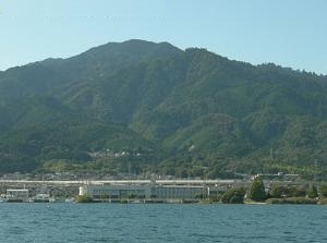
Mount Hiei from Otsu city
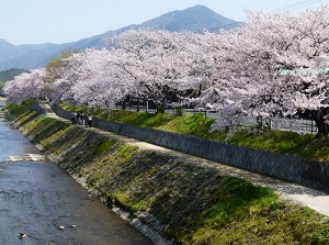
Mount Hiei from Takano River in Kyoto
Photo by Kyoto Free Photo
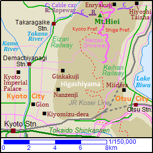
Mount Hiei is a mountain between Kyoto city and Otsu city.
It is on the prefectural border between Kyoto and Shiga Prefectures.
In Japanese, it is called Hieizan.
It is located about only 10 km northeast of central Kyoto city, and is located about 9 km north-northwest of central Otsu city.
There is the coast of Lake Biwa at the eastern foot of the mountain.
Mount Hiei has two peaks.
They are Dai-Hiei (大比叡, 848 m) and Shimeigatake (四明岳, 838 m).
Dai-Hiei peak is on the prefectural border and Shimeigatake peak is on the Kyoto side about 450 meters west of Dai-Hiei.
There is a park of observarory around Shimeigatake.
In a Japanese traditional cosmology, the direction of northeast is the unhappy one.
Mount Hiei is located to the northeast of Kyoto which was the capital of Japan, then Enryakuji temple were set up near the top of Hieizan in the 8th century.
Enryakuji is located to the northeast of Dai-Hiei.
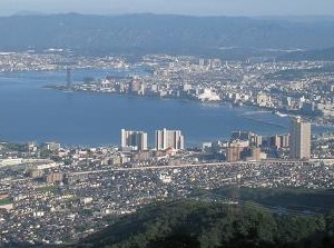
View of Otsu city from Mount Hiei
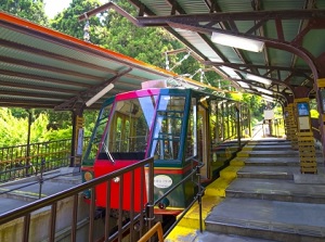
Cable car to Mount Hiei on Otsu side
We can reach the top of the mountain by cable car and ropeway from both Kyoto and Otsu sides.
And the toll road "Hieizan Driveway" runs along the ridge line of Mount Hiei, so we can reach by car.
From Kyoto station, route buses are operated to the top of the mountain.
How to get here
By route bus from Kyoto
About 1 hour and 15 to 20 minutes by route bus from Kyoto station.
By cable car from Kyoto side
- By Keihan Railway, go to Demachiyanagi terminal station.
- By Eizan Railway, about 26 minutes from Demachiyamagi to Yase-Hieizan-guchi.
- By cable car, about 9 minutes to the mountainside.
- By ropeway, about 3 minutes to the top.
- To Enryakuji, we can use shuttle bus. About 6 minutes.
By cable car from Otsu side
- By Keihan railway, go to Sakamoto station. About 16 minutes from Hama-Otsu.
- By route bus, about 4 minutes from Sakamoto to the cable car station.
(The distance is about 1 km. If you walk, it takes about 15 minutes.) - By cable car, about 11 minutes to the top.
- About 10 minutes walk to Enryakuji.