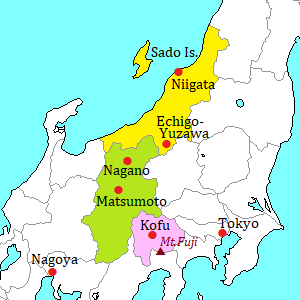
Kamikochi [上高地]
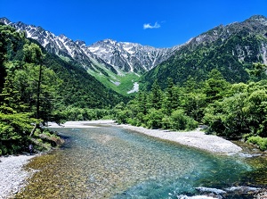
Kamikochi
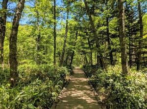
Walking trail in Kamikochi
Kamikochi is the most popular scenic spot in Northern Alps.
"O" in the word is pronounced long, so it is read as "Kamikôchi".
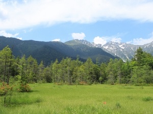
Kamikochi is a valley just close by the ridge of Northern Alps, and it is located at a level of about 1,500 meters.
And it is located about 30 km west of Matsumoto city.
Mount Hotaka (穂高岳) towers about 4 to 12 km north of Kamikochi.
It has eight main peaks, and the highest Oku-Hotaka peak (奥穂高岳) has a height of 3,190 meters which is the third highest mountain in Japan.
Mount Hotaka is one of the most popular mountains for climbing.
The climbers mostly start from Kamikochi.
Of course, they have appropriate mountaineering equipment and experience to climb.
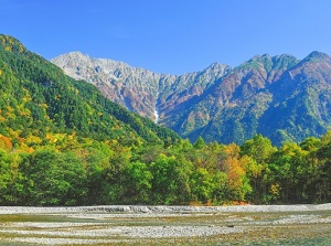
Mount Hotaka from Kamikochi
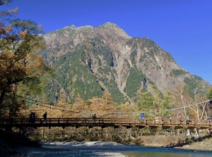
Yakedake from Kamikochi
And there is Mount Yake (焼岳, "Yakedake" in Japanese) about 2.5 km west of Kamikochi.
It is an active volcano, and is 2,455 meters high.
The last eruption was in 1915.
Azusa River (梓川) flows through the valley of Kamikochi, and flows down to Matsumoto city.
Kamikochi is a part of a national park, and is also designated as a national extraordinary scenic beauty and a national monument.
We can visit Kamikochi only from late April to mid-November.
We can enjoy the beautiful scenery of Northern Alps, lakes and forests.
To enter the area of Kamikochi, only route bus is used.
Even if you visit here by car, you must park the car at Sawando or Hirayu hot spring and change to the bus.
Taisho Pond (大正池)
Taisho Pond
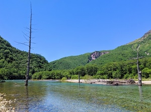
Withered trees in Taisho Pond
Taisho Pond is a dammed lake at the entrance of Kamikochi.
In Japanese, the last "o" is pronounced long and is called "Taishô-ike".
It was formed by dammed Azusa River by the eruption of Mount Yake in 1915.
The length is about 1 km and the width is 50 to 100 meters.
The standing withered trees in the pond are designeted as the national natural monuments.
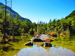
Tashiro Pond (田代池)
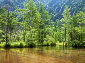
Tashiro Pond
Marsh around Tashiro Pond
Tashiro Pond is a small and shallow lake located about 0.5 km northeast of Taisho Pond.
It is called "Tashiro-ike" in Japanese.
This lake was also formed by the eruption of Mount Yake.
The water is very clear because subsoil water is springing out.
So some fishes are living.
Around this lake, a marsh spreads.
Reverend Walter Weston memorial plaque (ウォルター・ウェストン碑)
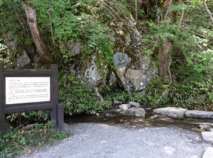
Walter Weston memorial plaque
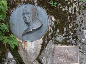
Reverend Walter Weston
Walter Weston (1861-1940) was a British missionary.
He had sometimes climbed various mountains as a hobby, when he had stayed in Japan.
Then he introduced the beautiful Japan Alps to the world for the first time in 1906.
Also he introduced the modern climbing as a sport to Japan.
This monument was erected for his achievement by Japanese Alpine Club in 1937.
It is located by Azusa River about 2 km north of Taisho Pond.
On the first Saturday and Sunday in June, Weston Festivel is held here by many climbers.
Kappa Bridge (河童橋)
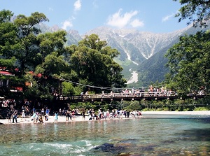
Kappa Bridge
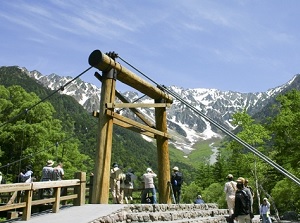
Kappa Bridge
Kappa Bridge ("Kappa-bashi" in Japanese) is a wooden suspension bridge located about 2.5 km northeast of Taisho Pond.
It is the most popular spot in Kamikochi, and is in the center of Kamikochi.
Azusa River flows under the bridge, and we can see the beautiful scenery of the peaks of Mount Hotaka and the active Mount Yake volcano.
There are the visitor center and some hotels around this spot.
And the bus terminal is near this spot.
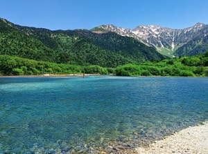
Myojin Pond (明神池)
Myojin Pond
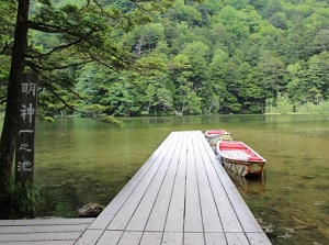
Myojin Pond
Myojin Pond is a small dammed lake located about 2.5 km upstream of Azusa River from Kappa Bridge.
In Japanese, the "o" in the word is pronounced long and is called "Myôjin-ike".
Two small ponds connect and are surrounded by forest.
Myojin Pond is a part of the precincts of Okumiya of Hotaka Shrine.
So you must pay the entrance fee (300 yen).
Okumiya of Hotaka Shrine (穂高神社奥宮)
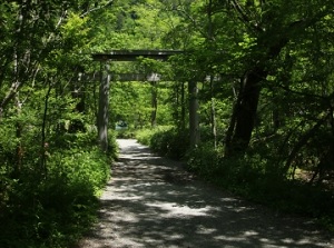
Entrance to Okumiya
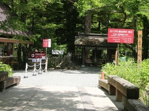
Okumiya
Okumiya is a branch shrine of Hotaka Shrine in Azumino town located about 25 km east-northeast as the crow flies. (Between Okumiya and the main shrine, there are high mountains.)
The guardian god of Japan Alps are enshrined.
There is a small hall of worship near Myojin Pond.
How to get here
From Matsumoto, by local train of Kamikochi Line of Alpico Kotsu railway, about 30 minutes to Shin-Shimashima terminal.
Then, by route bus, about 65 minutes from Shin-Shimashima station to Kamikochi bus terminal.
From Takayama, by route bus, about 1 hour and 30 minutes to Hirayu-onsen.
Then, by shuttle bus, about 25 minutes from Hirayu-onsen to Kamikochi bus terminal.
When you use a rental car, you park the car at Sawando or Hirayu-onsen and change to the shuttle bus.
From both parking lots, it takes 25 minutes to Kamikochi bus terminal.