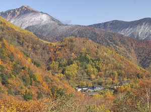
Norikura highland [乗鞍高原]
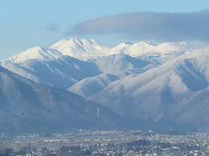
View of Mount Norikura from Matsumoto city
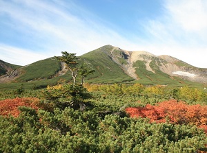
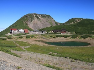
View of Mount Norikura from Echo Line
Photo by photolibrary
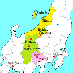
Norikura highland ("Norikura Kôgen" in Japanese) is located on the eastern slope of Mount Norikura.
It is located about 30 to 40 km west-southwest of Matsumoto city and about 15 km south of Kamikochi.
Mount Norikura (乗鞍岳) is a mountain in the southern part of Northern Alps.
It has 23 peaks and are 2,500 to 3,000 meters high.
The highest peak is Kengamine (3,026 m).
Mount Norikura is an active volcano, but the last eruption was about 2,000 years ago.
Now this volcano is quite tranquil.
Norikura highland was formed by the lava flow of Mount Norikura.
The altitude is about 1,100 to 1,800 meters.
The highland is covered with beautiful forests, and has a rich natural environment.
There is Norikura-kogen resort town at the level of about 1,600 meters.
There are some hotels and a few ski areas.
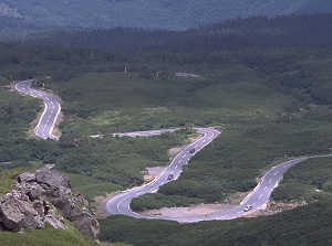
Norikura Echo Line
Photo by Nagano Tourism Organization
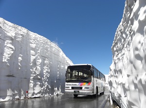
Norikura Echo Line in late April
Photo by Nagano Tourism Organization
A road Norikura Echo Line runs from the resort town.
It reaches the ridge of Mount Norikura and connects to a road Norikura Sky Line on the western slope of the mountain.
So we can easily go to the top Northern Alps at a height of 3,000 meters above sea level.
But, the road is close from November to April.
And the passage of general car except bus and taxi is prohibited.
If you use a rental car, you must park the car at the resort town and change to shuttle bus.
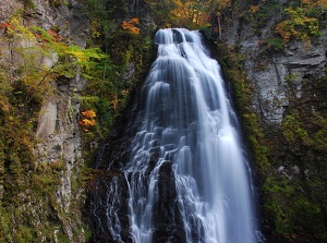
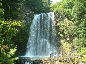
Bandokoro Falls
Photo by photolibrary
Ichinose Enchi
Bandokoro Falls (番所大滝)
Bandokoro Falls is a waterfall located about 3 km east of Norikura-kogen resort.
It is the largest waterfall in Norikura highland, and is located at the level of 1,240 meters.
The waterfall is about 40 meters high and 15 meters wide, and the water falls strongly.
All rocks around this waterfall are lavas from Mount Norikura.
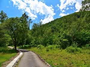
Ichinose Enchi park (一の瀬園地)
Ichinose Enchi is a broad park spreading to the south of Norikura-kogen resort.
It is a natural park, and we can enjoy the nature of Norikura.
In the site, there are some walking trails, and we can tour by rental bicycle.
Zengoro Falls
Ushidome Pond
Zengorô Falls (善五郎の滝)
Zengorô Falls is a waterfall located about 0.7 km southwest of Norikura-kogen resort.
It is at the level of 1,500 meters.
The waterfall is about 25 meters high and about 10 meters wide.
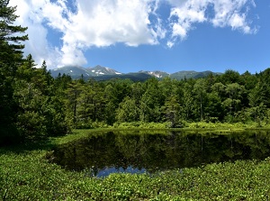
Ushidome Pond (牛留池)
Ushidome Pond is a small lake located about 1 km of Norikura-kogen resort.
It is in a forest, and the water is clear.
A walking trail is set up around the lake, and we can enjoy the nature of the forest.
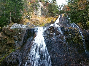
Sanbon Falls
Tatamidaira on Mount Norikura
Sanbon Falls (三本滝)
Sanbon Falls is a waterfall located about 3 km west of Norikura-kogen resort.
It is at the level of 1,800 meters.
"Sanbon-taki" in Japanese means "three waterfalls".
So we can see three waterfalls evidently.
Tatamidaira (畳平)
Tatamidaira is a bus terminal around the top of Mount Norikura.
It is located at the level of about 2,700 meters.
The buses come to this terminal from both Matsumoto and Takayama.
Around here, there are Fujimi peak (2,817 m), Daikoku peak (2,772 m) and Ebisu peak (2,831 m) of Mount Norikura.
And near the terminal, there is an alpine meadow with walking trails, and we can see many alpine plants.
Shirahone Onsen
Photo by Nagano Tourism Organization
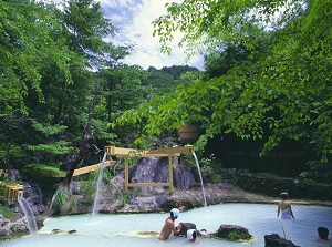
Outdoor bath in Shirahone Onsen
Photo by Nagano Tourism Organization
Shirahone Onsen (白骨温泉)
Shirahone Onsen is a hot spring resort located about 4 km north of Norikura-kogen resort town.
The hot spring resort is in a deep valley.
"Shirahone" means "white bone".
The spring water is milky white, and solids of calcium carbonate are generated in the water.
The bathtub covered with white solids looks like "shirahone".
About a dozen of hotels and ryokans are in this resort.
How to get here
From Matsumoto, by local train on Kamikochi Line, about 30 minutes to Shin-Shimashima terminal.
Then, by route bus, from Shin-Shimashima station about 53 minutes to Kanko-Center (Norikura-kogen resort), about 1 hours and 24 minutes to Shirahone hot spring resort.
And, by shuttle bus, about 50 minutes from there to Tatamidaira.
From Takayama, by route bus, about 1 hour and 30 minutes to Hirayu-onsen.
Then, by shuttle bus, about 1 hour from there to Tatamidaira.